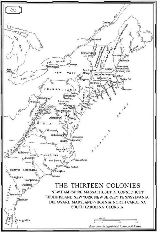
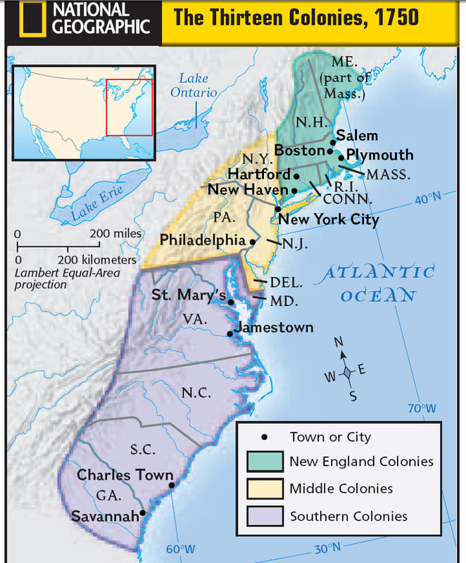
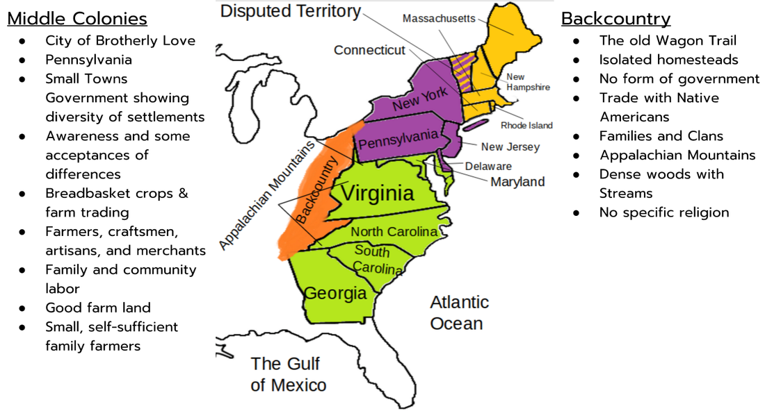
There were four different regions of the colonies, each with their own unique characteristics, and some similar. Directly below are the descriptions, and below that are my maps of the colonies, with a shortened list of their characteristics there. Below those are two much more detailed maps that do not belong to me, but give a more accurate idea of state and property boundries in the colonies.
Colonial Regions:
New EnglandMassachusetts, Connecticut, Rhode Island, New Hampshire
In New England the soil was rocky and the growing season was short. It was cold and most of their profits were from fishing, shipbuilding, and the sale of timber. Religion controlled politics early on, but as the need for revolution increased, there were more town meetings and democratic discussions.
|
MiddleNew York, New Jersey, Delaware, Pennsylvania
In the Middle Colonies, many people survived on self-sufficient farms and profit from the fur trade. The land was good for farming and the people governed similar to New England, but with elected assemblies instead of unorganized town meetings. It was known for religious freedom and tolerance.
|
SouthernVirginia, Maryland, South Carolina, North Carolina, Georgia
The Southern colonies were the first region to be settled in. Jamestown was the first settlement and the southern colonies were home to the House of Burgesses. The powerful and rich ruled. There were many slaves and large plantations because of the good soil. Religion didn't have a major influence on the southern colonies.
|
BackcountryAround the Appalachian Mountains
The backcountry was west of the colonies and contained isolated homesteads ruled by nobody in particular. It was an extremely rural area in and east of the Appalachian Mountains. There was trade with the Natives and the geography contained mainly forests, hills, and streams.
|
|

|
For more detailed maps, click on the images below.